Land & Revenue
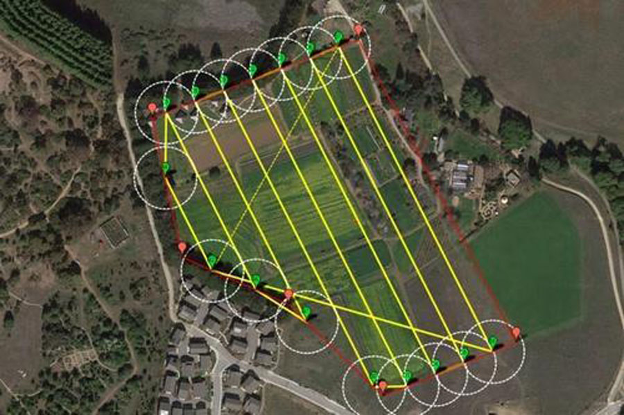
We use drones to capture aerial images which greatly accelerate and simplify surveys for land management and planning. Data provided by us is used for site scouting, allotment planning, construction of roads, buildings and utilities. High resolution orthophotos enable surveyors to perform highly-accurate distance, surface measurements and delineating cadastral property boundaries. Data collected using drones help to examine the existing social and environmental conditions for revenue planning.
We provide a broad range of Digital Land Surveying and aerial Mapping Services from Topographic survey with contour plan to smart city survey ,Road & Highways survey to Pipeline and canal route studies, Site plan preparations, Reservoir studies, River studies using drone and DGPS .Our services includes
- Aerial Photogrammetric Surveys & Mapping
- Topographic survey and contouring.
- Boundary Surveys.
- 3D Mapping
- Subdivision Design And Platting
- Area Computations
- Volume Calculations
- Asset mapping/Base Map Preparation
- Digitization of plans and maps
- Master mapping
- Digital Terrain Modeling
- Smart city survey for planning
- Residential Surveys & Settlement Surveys
- House Layouts
- Road Surveys
- Pipeline And Wellhead Detection (Land And Water)